Ayers Rock
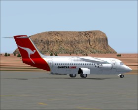
Ayers Rock (or Uluru)  is a large rock in the desert of Northern Territory, Australia. Start at the nearby Ayers Rock Airport (YAYE)
  and depending on the weather the rock may be visible at heading 155. The surroundings are somewhat monotonous, however, you should enjoy the sight of the characteristic red sand. If you are in a small aircraft you may try to land on the rock.
If you are interested in more Australian flights you should get the free Vista Australis (VOZ) add-on.