Greenland
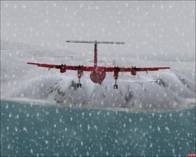
Greenland  is the world's largest island and mostly covered by ice. Flying on Greenland is about challenging the tough weather conditions and enjoying the atmosphere of the country with plenty of mountains, fjords, snow, ice, and the great inland ice. Moreover the airports are pretty challenging to fly. To increase the flight experience always fly with real-world weather.
Airports
There is 13 public aerodromes on the island, 11 on the west coast (mostly in the southern half) and 2 on the east coast. Futhermore the AIP lists 50 heliports though none of them are present in the standard scenery of FS2004 and FSX. The scenery add-on described elsewhere on this page adds some of these heliports and some boat docks. The following table lists the aerodromes:
| Code | Airport | Location | AIP | Map and photo | Approach OCA(H) |
Rwy surface | Rwy feet |
|---|---|---|---|---|---|---|---|
| BGAA | Aasiaat Airport | Aasiaat (Egedesminde) | AIP | |
NDB+DME 580 (500) |
Asphalt | 2600 |
| BGBW | Narsarsuaq Airport | Narsarsuaq | AIP |  |
NDB+DME 1500 (1490) |
Concrete | 6000 |
| BGCO | Nerlerit Inaat Airport | Nerlerit Inaat (Constable Pynt) | AIP | |
L circling 1000 (955) |
Gravel | 3200 |
| BGGH | Nuuk Airport | Nuuk (Godthåb) | AIP | |
LLZ/DME 630 (350) |
Asphalt | 3100 |
| BGJN | Ilulissat Airport | Ilulissat (Jakobshavn) | AIP | |
NDB+DME 730 (640) |
Asphalt | 2800 |
| BGKK | Kulusuk Airport | Kulusuk | AIP | |
NDB 890 (780) |
Gravel | 4000 |
| BGMQ | Maniitsoq Airport | Maniitsoq (Sukkertoppen) | AIP | |
NDB+DME 700 (610) |
Asphalt | 2600 |
| BGPT | Paamiut Airport (build 2007 - not present in FSX) | Paamiut (Frederikshåb) | AIP | NDB+DME 660 (548) |
Asphalt | 2600 | |
| BGQQ | Qaanaaq Airport | Qaanaaq (Thule) | AIP | |
NDB+DME 1320 (1270) |
Gravel | 2900 |
| BGSF | Kangerlussuaq Airport | Kangerlussuaq (Søndre Strømfjord) | AIP | |
LLZ/DME+MKR 450 (350) |
Asphalt | 9200 |
| BGSS | Sisimiut Airport | Sisimiut (Holsteinsborg) | AIP | |
NDB+DME 500 (470) |
Asphalt | 2600 |
| BGTL | Thule Air Base | Thule airbase at Pituffik | AIP | |
ILS/DME 453 (250) |
Asphalt | 9900 |
| BGUK | Upernavik Airport | Upernavik | AIP | |
NDB+DME 900 (500) |
Asphalt | 2600 |
| BGUQ | Uummannaq Airport | Qaarsut at Uummannaq | AIP | |
L+DME circling 1150 (860) |
Gravel | 2900 |
All airports have runway lighting and fueling station.
Scenery
- Extreme Southwestgreenland by Ulrik Motzfeldt
- LOD 11 mesh and redesigned coastlines and lakes covering western Greenland between northern latitudes 62° and 65°
- Extreme Westgreenland by Ulrik Motzfeldt
- LOD 11 mesh and redesigned coastlines and lakes covering western Greenland between northern latitudes 65° and 68°
Aircraft
For domestic Air Greenland flights try this excellent freeware Dash 7 aircraft which is the prefered aircraft of Air Greenland for domestic flights. It comes in old Air Greenland livery, so update it with the new livery in high-resolution or low-resolution, and this livery update for both resolutions.
International flights
Fly one of the two Air Greenland international flights from Copenhagen, Denmark (about 4 hours):
- EKCH-BGSF in Airbus A330-200
- EKCH-BGBW in Boeing 757-200
Alternatively, for a shorter flight, start at Reykjavik, Iceland (BIRK) and fly to BGSF.
Domestic flights
Try one of the scheduled flights of Air Greenland. See the route map and flight schedule on their website. The only aeroplane type for domestic flights is the Dash 7. Flying with real-world weather is a must for these flights.
Make a taxi flight with passengers that have just arrived from abroad to BGSF, and going to the capital at BGGH (~1 hour flight). Choose the Learjet 45 or King Air 350. Download this flight plan. When given an approach by ATC request the "localizer 23 approach QT transition" and approach using this chart as if you were approaching via the NUTKA transition.
Also try the challenging flights in the scenery add-on described elsewhere on this page.
West coast tour
Make a (long) tour where you see the Greenlandic west coast by flying from south to north while paying a visit to all the airports you pass. Visit the airports in the same order as the table above. Below is comments to some of the airports on the tour.
Nuuk: The capital of Greenland, however, not one of the greatest airports.
Kangerlussuaq: The main civil airport of Greenland. The city is connected to the ocean by a long fjord. You may follow this fjord visually when arriving or departing to the airport.
Sisimiut: If flying in a larger plane or if the visibility is poor this airport approach may be very difficult due to mountains on both runway endings. However, I believe the scenery is erroneous, and that the approach is less difficult in real-world.
Qaarsut: The approach to Qaarsut airport is very beautiful. You will fly aside a mountain before you land.
Thule: Thule is an American military airbase which has an important strategic location.
Qaanaaq: The trees and runway on Qaanaaq airport are moving (this always happens when you get close to the poles). Qaanaaq is the northernmost airport in Greenland. If you, however, still want to go further north you may follow the strait between Greenland and Canada. At the north of Greenland you may fly east or fly to Alert airport in Canada, the world's northernmost permanent airport.
Links
- Air Greenland - the national airline of Greenland
- AIP Greenland - airport information, charts, e.g., from the Danish civil aviation authority
- OPMET Grønland - METAR, TAF, NOTAM, etc.
- FlightSim Greenland