Innsbruck
Innsbruck is a city in Austria located in a valley between mountains. Consequently Innsbruck Airport (LOWI) 
 has a complicated approach due to its location. The airport elevation is 1900 ft and the main runway 8/26 is 6550 ft long. Caution the foehn wind.
When flying by IFR you can make a LLZ/DME approach from either west or east, both takes you down the valley. Once in the valley a final Visual Approach Procedure is required before landing. For both LLZ/DME approaches there exists a visual procedure for a rwy 8 and rwy 26 landing. Due to terrain in front of rwy 8 a straight-in landing is only possible at the east approach rwy 26 landing (LLZ offset 5° from runway). The most difficult one is the west approach rwy 8 landing that requires two visual right turns at about 180° in the valley before landing.
Landing on rwy 8 from either LLZ/DME approach is difficult because it is almost impossible to keep visual contact with the rwy during the right-hand circuit (in larger planes) and because the scenery is incomplete. I follow the power line running parallel south of the rwy and initiate the final right turn with at least a 30° bank when the line starts to curve.
Remark that the LLZ/DME 26 is simulated as ILS/DME in FS2004 because you have glide slope available on some of the approach. The LLZ/DME 8 is missing in FS2004 but is included in the Active Approach described below.
Find charts for Innsbruck here, here or in the Active Approach.
Addons
Remark: All of the following addons are developed for FS2004.
- Scenery Enhancements for the Innsbruck (LOWI), Austria by Holger Sandmann
- Includes roads, railroads, streams, river, landclass, and waterclass for the Innsbruck area. These are useful for the visual part of the approaches and departures.
- Innsbruck-LOWI version 2 and Innsbruck-lowi v2 update by Johan Thiers
- Improves the airport scenery. Includes the Active Approach by Jim Vile.
- Active Approach - LOWI (Innsbruck, Austria) by Jim Vile
- - Fixes approaching AI traffic so it doesn't hit terrain.
- Adds the missing runway 8 localizer.
- Adds additional IFR approaches and transitions, including the runway 8 localizer approach and several STAR procedures.
- Includes all Jeppesen charts for the airport. - Alps LOD10 Topo Mesh - Austria and Italy by Holger Sandmann and Jonathan de Ferranti
- 38m terrain mesh
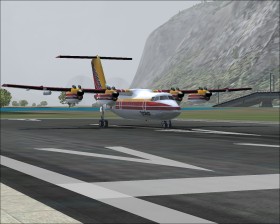
- Dash 7 and FS9 update by the Dash 7 Project
- Excellent aircraft that comes with the Tyrolean Airways livery. Tyrolean was an airline based in Innsbruck.
IFR Schwechat - Innsbruck
Make an IFR flight from Schwechat (LOWW) in the Austrian capital Vienna to Innsbruck. Download this flight plan that is based on real SID/STAR. When ATC gives you the approach request "localizer runway 26 approach RTT transition" since you are approaching from the east. When cleared for the approach follow the LOC DME EAST chart and finally the Visual Approach Procedure chart to the assigned runway. If cleared for rwy 8 disregard the ATC instruction of a left-hand circuit, and instead make a right-hand circiut as prescribed on the chart.