Maldives
The Maldives  is a republic south of India in the Indian Ocean, and a popular tourist destination. The country consists of 26 atolls that form 1192 islets (map).
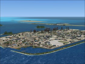
The capital of the Maldives is Malé which is located on its own island. On an adjacent island to Male is the Malé International Airport which is the base for most international flights. The eastern side of the airport has a port for seaplanes. Both the city and airport of Malé is very well represented in FSX.
Airports
- Male (VRMM), 10500 ft concrete runway, ILS approach

- Gan (VRMG), 8100 ft concrete runway, NDB and GPS approach
- Hanimaadhoo (VRMH), 4000 ft bituminus runway, GPS approach
- Kadhdhoo (VRMK), 4000 ft bituminus runway, NDB and GPS approach
- Kaadedhdhoo (VRMT), 4000 ft bituminus runway, NDB and GPS approach
AIP and charts for the Maldives is available for free on this site.
Domestic airliners
- Trans Maldivian Airways, 12 DHC-6 Twin Otter
- Maldivian Air Taxi, 17 DHC-6 Twin Otter
- Island Aviation Services, 1 DHC-8, 3 Dornier Do 228
The Twin Otters are seaplanes flying between the islands. Malé Airport has a seaport for the Twin Otters. Island Aviation Services operates scheduled flights between the 5 airports with runways.
Project Globe Twotter has made a DHC-6 300 for FS2004 in Maldivian Air Taxi livery.
Flights
Try one of the following flights:
Scheduled domestic flight in the Cessna C208B Grand Caravan from Malé (VRMM) to one of the other domestic airports.
Taxi flight in the de Havilland Beaver DHC2 from Malé (VRMM) to one of the tourist resort islands.
An international flights to Malé (VRMM) in the Boeings or Bombardiers.
A sightseeing tour at the Malé area in one of the small GA aircrafts.